 Autumn, 1984: last days . . . . .
These pictures and notes by courtesy of Mark McManus
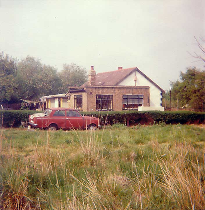
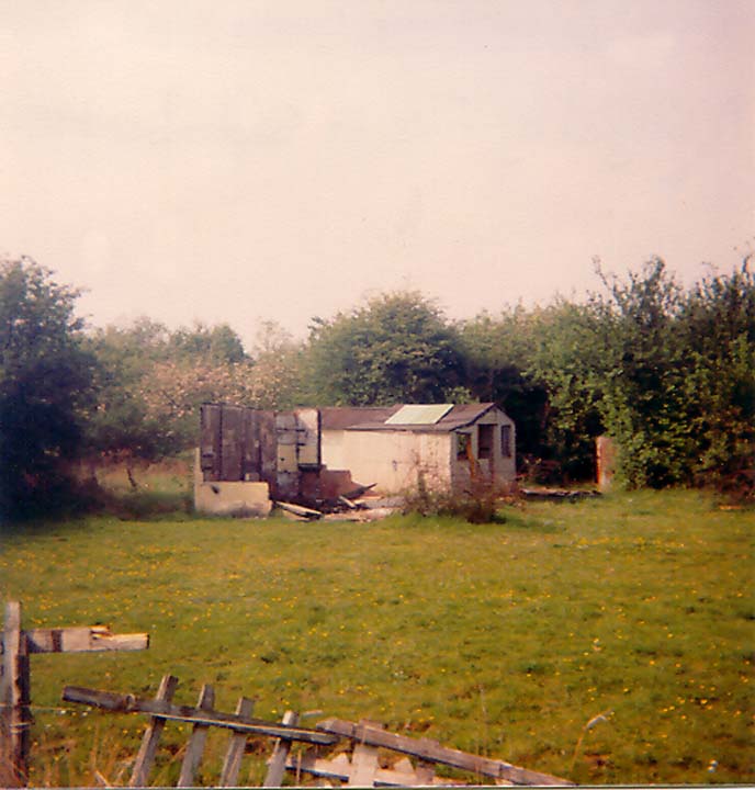 "Colin", Crest Avenue; seriously damaged
by fire in the autumn of 1983, owned by the Cakebread family of Canning
Town. Their relatives, the Howsons, owned "Rose Ville" at
the junction of Margaret Avenue and Beech Hall Gardens.
"Colin", Crest Avenue; seriously damaged
by fire in the autumn of 1983, owned by the Cakebread family of Canning
Town. Their relatives, the Howsons, owned "Rose Ville" at
the junction of Margaret Avenue and Beech Hall Gardens.
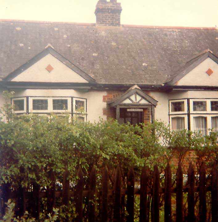
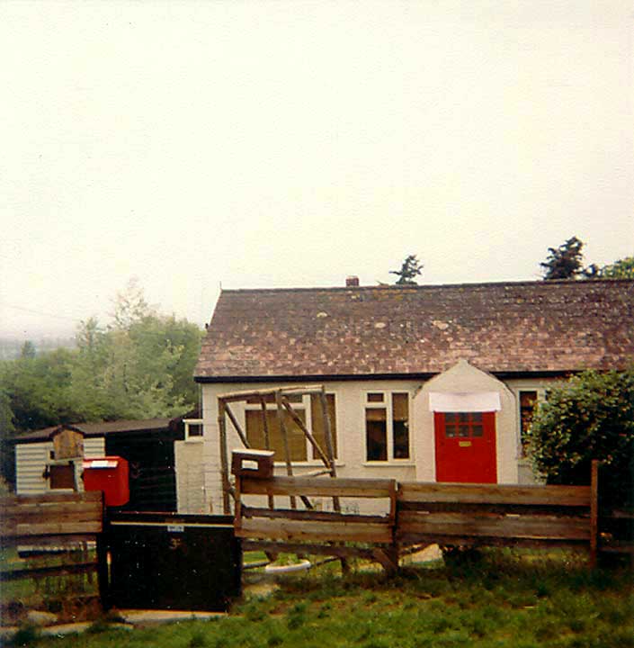 "Hawthorn", Hillcrest
Avenue; owned by the Burke family until 1983, when it became a home
for the wardens of The Haven Plotland Museum. It fell out of use
following the construction of the visitors' centre and was demolished in
1999.
"Hawthorn", Hillcrest
Avenue; owned by the Burke family until 1983, when it became a home
for the wardens of The Haven Plotland Museum. It fell out of use
following the construction of the visitors' centre and was demolished in
1999.
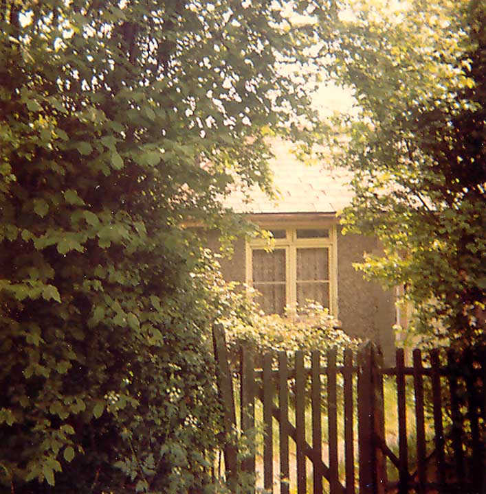
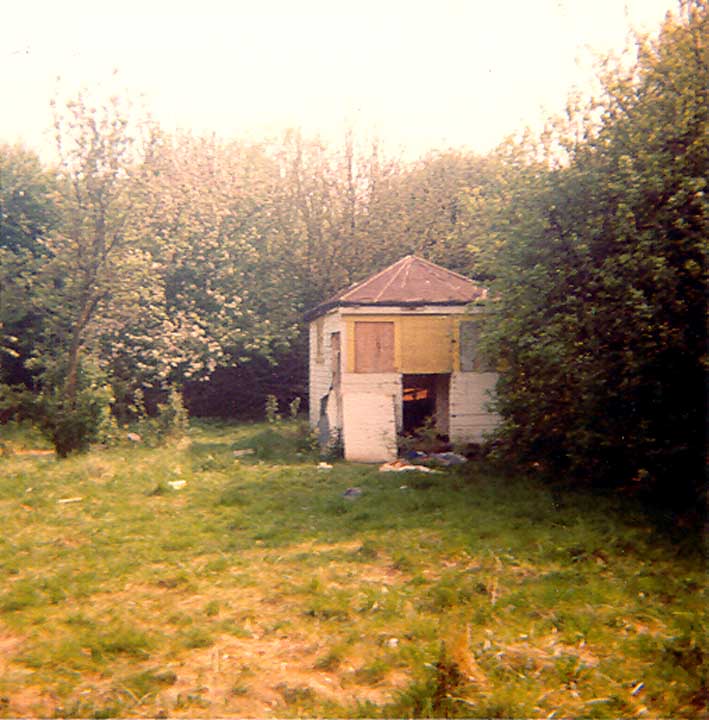 A shack in Arcadian Gardens, only a few months
after dereliction, used by the Hibell family of Limehouse.
A shack in Arcadian Gardens, only a few months
after dereliction, used by the Hibell family of Limehouse.
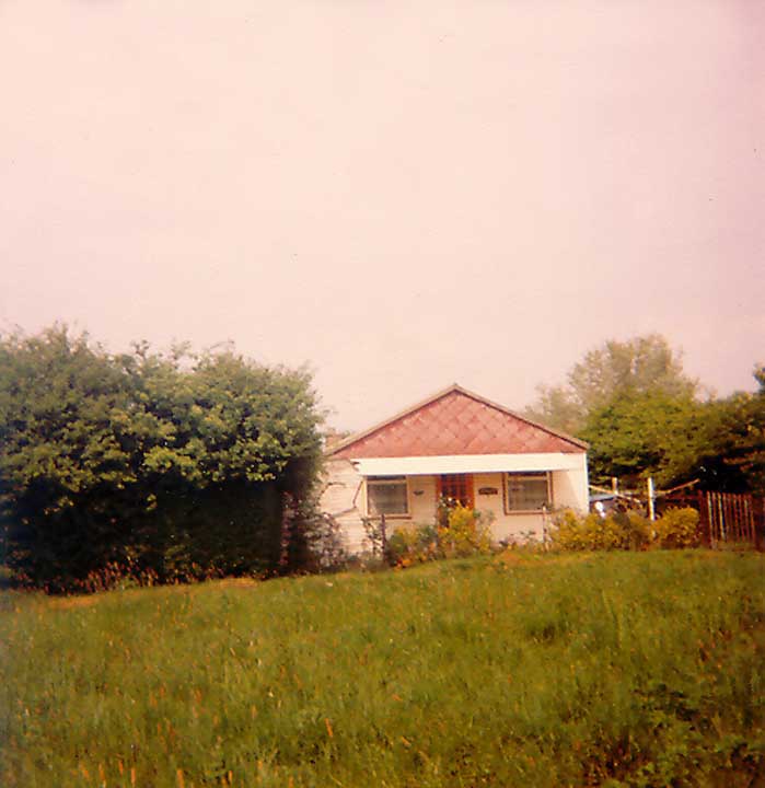
 "Chook-A-Berry", Western Avenue; occupied by the Bletch
family until its destruction in late 1984.
"Chook-A-Berry", Western Avenue; occupied by the Bletch
family until its destruction in late 1984.
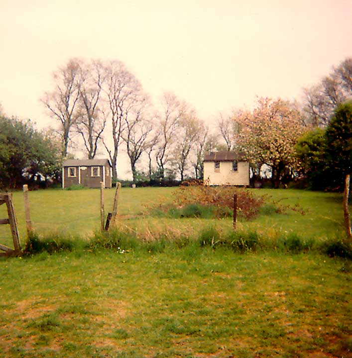
 "Grangewood", Beech hall
gardens; occupied by the Hayball family until late 1984.
"Grangewood", Beech hall
gardens; occupied by the Hayball family until late 1984.
 Beech Hall Gardens, showing one of the
thin paths built by the plotlanders for their shopping trolleys.
"Grangewood" is on the left.
Beech Hall Gardens, showing one of the
thin paths built by the plotlanders for their shopping trolleys.
"Grangewood" is on the left.
 "Glencrest" at the junction
of Glenwood Gardens and Crest Avenue. A holiday home at the time of
its demolition in summer 1984, it was once a home to the Hinchcliff family
(electoral register, 1964). Its nameplate is an exhibit in the
plotland museum.
"Glencrest" at the junction
of Glenwood Gardens and Crest Avenue. A holiday home at the time of
its demolition in summer 1984, it was once a home to the Hinchcliff family
(electoral register, 1964). Its nameplate is an exhibit in the
plotland museum.
 "Thorngrove", First
Avenue; occupied by the Thompson family until 1992. Its
remains are still highly visible.
"Thorngrove", First
Avenue; occupied by the Thompson family until 1992. Its
remains are still highly visible.
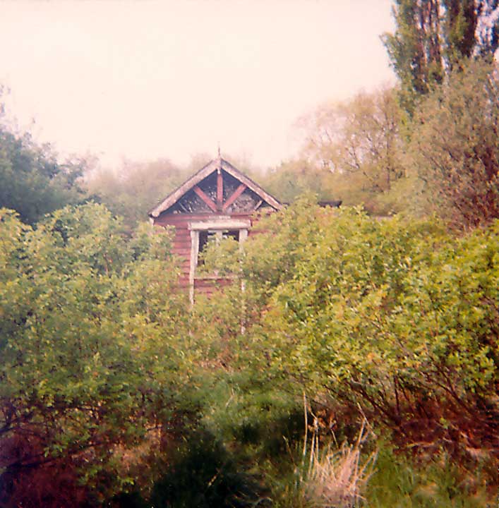
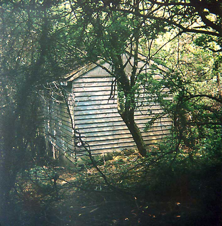 Overgrown by scrub, a derelict shack
to the rear of the remains of "Anthelen", Fourth Avenue, owned
by a Mr Anthony of North London.
Overgrown by scrub, a derelict shack
to the rear of the remains of "Anthelen", Fourth Avenue, owned
by a Mr Anthony of North London.
 "High Trees" and "Four
Elms", Hillcrest Avenue; the overgrown patch in the garden is
the remains of an air-raid shelter; used by the Joyner family until 1985.
"High Trees" and "Four
Elms", Hillcrest Avenue; the overgrown patch in the garden is
the remains of an air-raid shelter; used by the Joyner family until 1985.
 The derelict "Rosemary",
Highland Gardens; despite its diminutive size, it was once a
residence for the Wallace family (electoral register, 1964); collapsed in
1985.
The derelict "Rosemary",
Highland Gardens; despite its diminutive size, it was once a
residence for the Wallace family (electoral register, 1964); collapsed in
1985.
 "Viewgrand", Hillcrest
Avenue; destroyed in 1985, the small chimney is still visible on the
site; not "Iona" as the leaflet for the
plotland trail suggests!
"Viewgrand", Hillcrest
Avenue; destroyed in 1985, the small chimney is still visible on the
site; not "Iona" as the leaflet for the
plotland trail suggests!
 "Iona", Hillcrest Avenue; owned by a local man, demolished in
summer, 1984. The nameplate can be viewed at the museum.
"Iona", Hillcrest Avenue; owned by a local man, demolished in
summer, 1984. The nameplate can be viewed at the museum.
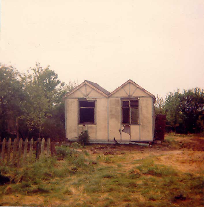
 "Everest", First
Avenue; originally a shop, it was home to the Elliott family until
demolition in 1985.
"Everest", First
Avenue; originally a shop, it was home to the Elliott family until
demolition in 1985.
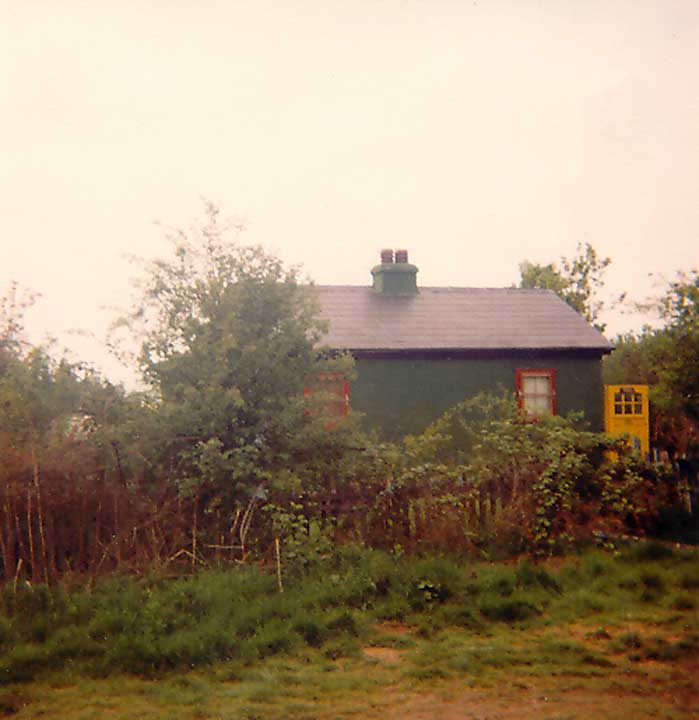
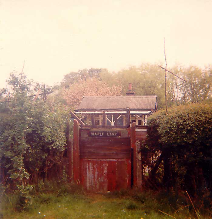 "Maple Leaf", Berry Drive; originally
home to the Seeley family (electoral register 1949), later to Ernest
South. His neighbour at "Ruby", whom he mysteriously
called Ada, was actually named Rose Frasi. "Maple Leaf"
was demolished in summer, 1984, but its nameplate survives in the plotland
museum.
"Maple Leaf", Berry Drive; originally
home to the Seeley family (electoral register 1949), later to Ernest
South. His neighbour at "Ruby", whom he mysteriously
called Ada, was actually named Rose Frasi. "Maple Leaf"
was demolished in summer, 1984, but its nameplate survives in the plotland
museum.